
Home / Zenmuse payloads / DJI Zenmuse L2
Quote
DJI Zenmuse L2
LiDAR + RGB mapping
- LiDAR
- Frame-based
- RGB
- 4/3 CMOS
- Accuracy
- 4 cm vertical
- Mounts on
- Matrice 350 RTK
Authorized DJI DealerGenuine, US-warranty products
Ships worldwideFree US shipping over $500
30-day returnsUnopened and unactivated
Buying for a business or reselling? Get wholesale pricing →
| LiDAR | Frame-based, 5 returns |
|---|---|
| RGB | 4/3 CMOS, 20 MP |
| Accuracy | 4 cm vertical, 5 cm horizontal |
| Mounts on | Matrice 350 RTK, Matrice 300 RTK, Matrice 400 |
In the box
PayloadProtective case
Overview
About the Zenmuse L2
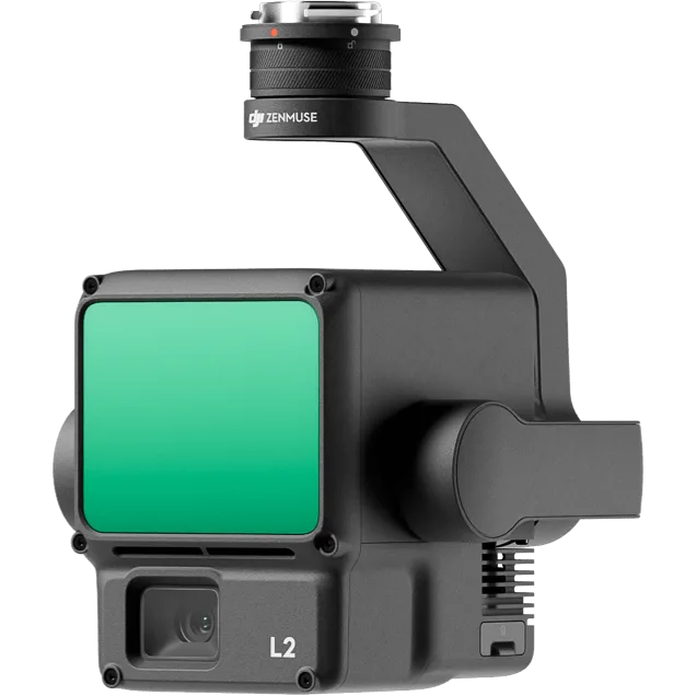
DJI Zenmuse L2 is a LiDAR payload with a built-in 4/3 RGB mapping camera. It captures true-color 3D point clouds for topographic survey, construction, forestry and power line work. It pairs with DJI Terra for processing, so you can go from flight to deliverable in one workflow.
Highlights
- System accuracy: 4 cm vertical, 5 cm horizontal at 150 m (DJI test conditions, processed in DJI Terra)
- Up to 5 returns, up to 1.2 million points per second with multiple returns
- Detection range of 250 m at 10% reflectivity and 450 m at 50%
- 4/3 CMOS RGB camera, 20 MP
- Repetitive and non-repetitive scan patterns
- 905 g, IP54
Who it's for
Survey and mapping teams who need accurate ground models, including under vegetation, without a long field day. It mounts on Matrice 400, Matrice 350 RTK and Matrice 300 RTK (with DJI RC Plus). Zenmuse L2 is quote only: contact us for bundles and training.
Guides
Questions owners ask
- LiDAR drones explained: when you need LiDAR (Zenmuse L2)
- DJI Zenmuse payloads explained (L3, L2, P1, H30T)
- Can you map with the DJI Flip? Photogrammetry and LiDAR questions
- Can you map with the DJI Air 3S? Photogrammetry and LiDAR questions
- Can you map with the DJI Mini 4 Pro? Photogrammetry and LiDAR questions
- Can you map with the DJI Mini 5 Pro? Photogrammetry and LiDAR questions
- Can you map with the DJI Mavic 3 Pro? Photogrammetry and LiDAR questions
- Can you map with the DJI Mavic 4 Pro? Photogrammetry and LiDAR questions
Pairs well with
You might also like


Your history